brewery · Penn Yan
Abandon Brewing Company →
A farm brewery in a restored 1800s barn with Keuka views, a kitchen, live music, and event space.
Official visitor information ↗Catalog source checked 2026-08-25. Confirm details before visiting.
Central Finger Lakes · Field guide
The Y-shaped lake with the pioneer wineries.
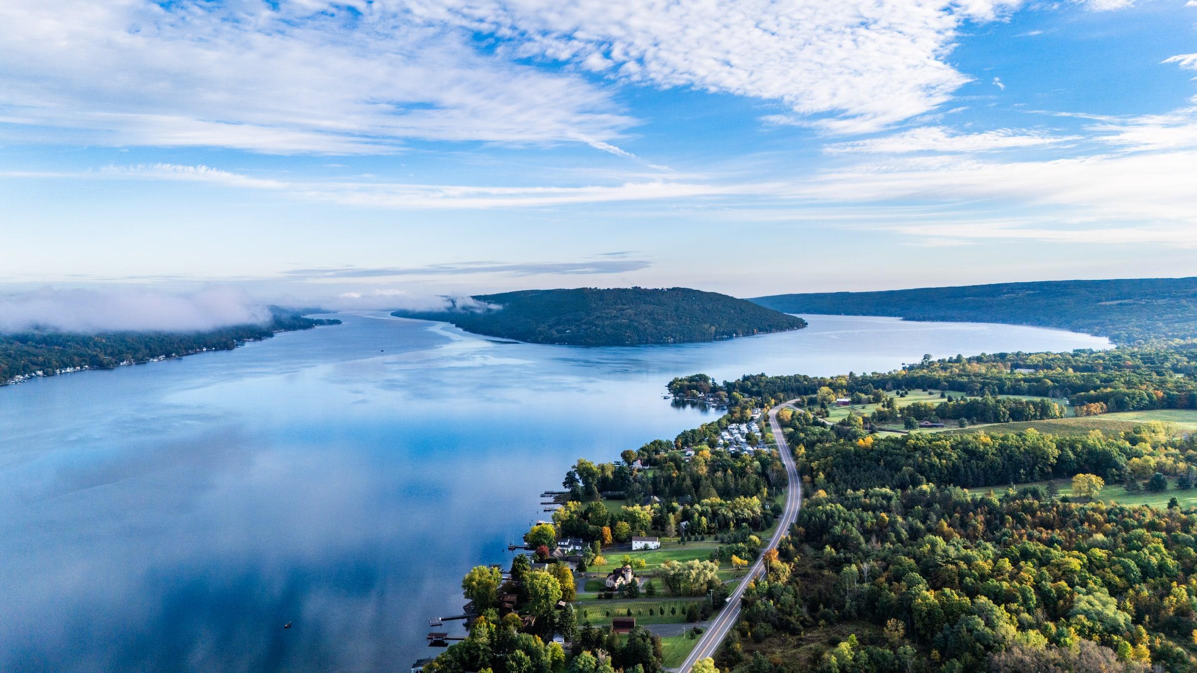
Keuka's branching shoreline makes the choice of a home base part of the adventure. Begin around Hammondsport, Penn Yan, or Branchport, then bring together lake views, local stops, and time to linger on the same side of the water.
Approximate lake center, not an access point
Our planning approach
A few places to begin
A varied starting set from the public catalog—not a fixed tour. Save what catches your eye, then bring those ideas into your own itinerary.
brewery · Penn Yan
A farm brewery in a restored 1800s barn with Keuka views, a kitchen, live music, and event space.
Official visitor information ↗Catalog source checked 2026-08-25. Confirm details before visiting.
winery · Hammondsport
Ravines' Keuka tasting room pairs dry, site-focused wines with a broad lake view and a small food menu.
Official visitor information ↗Catalog source checked 2026-08-25. Confirm details before visiting.
marina · Branchport
A Branchport marina focused on Keuka boat rentals, slips, dockage, boat sales, and lake access near the northwest branch.
Official visitor information ↗Catalog source checked 2026-08-25. Confirm details before visiting.
museum · Hammondsport
Museum dedicated to the region's boatbuilding heritage, with historic Finger Lakes watercraft and exhibits on builders, design, and restoration.
Official visitor information ↗Catalog source checked 2026-08-26. Confirm details before visiting.
park · Penn Yan
Village waterfront park with swimming, trails, picnic space, pavilion rental, volleyball, a playground, lake views, and restrooms.
Official visitor information ↗Catalog source checked 2026-08-25. Confirm details before visiting.
nature preserve · Wheeler
Rustic 998-acre state forest crossed by the Bristol Hills Branch of the Finger Lakes Trail, with primitive camping and wildlife habitat.
Official visitor information ↗Catalog source checked 2026-08-25. Confirm details before visiting.
Around the lake
The Y-shaped shoreline connects Penn Yan, Branchport, and Hammondsport, so the right arm matters when planning a day.
Regional orientation
The markers use each lake’s approximate geographic center, from west to east. Choose one to open its profile.
Regional markers are approximate centers, not shoreline boundaries or directions. Open the detailed Keuka Lake map →
Through the lens
Plan your visit
Choose your dates, your home base, and how much driving feels right. The planner can bring your saved places into a flexible draft; check hours, access, and reservations directly before relying on any stop.
Check current conditions →A planning starting point
Start small: choose a base and a few saved ideas, with time left to linger.
A planning starting point
Build from the stories and places that interest you, rather than a regional checklist.
A planning starting point
Set arrival and departure times, add your favorites, and decide how far you want to go.
From the reviewed calendar
Oct 17
Vineyard View Winery · Keuka Park · from 2:00 PM · $75.00
Nov 3
Saunders Finger Lakes Museum · Branchport · from 5:30 PM
A small selection of upcoming listings; recurring dates are grouped here. Confirm availability and changes with the organizer.
Before you go
Use the managing agency or operator for the exact place and date. Public access, beach openings, water advisories, and trail conditions can change; a lake overview is not a current safety report.
Current-condition sources →Yes. Save places and events while exploring, then select those ideas in the trip planner. Guest saves stay on this device; sign in to keep account-based favorites and saved itineraries.
Open the Keuka Lake planner →The History room contains released stories and their sources. Developing stories show what remains uncertain; private research is not displayed as an established fact.
Explore the regional History room →Bring it all together
Turn what caught your eye into a visual itinerary. Start with this lake, bring your favorites, and leave room to change your mind.